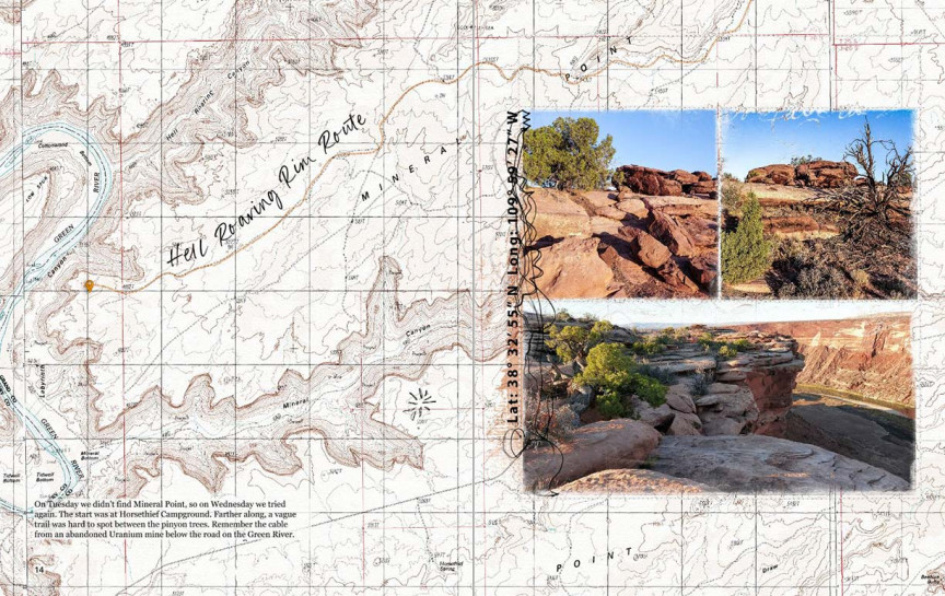
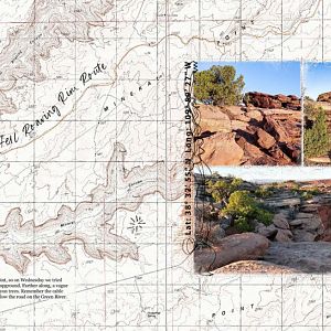
Hell Roaring Rim Route
aA Brushes, Geomarker, Paper, Urban Stitchez, Recipe Template Pack
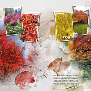
On Tuesday we didn't find Mineral Point, so on Wednesday we tried again. The start was at Horsethief Campground. Farther along, a vague trail was hard to spot between the pinyon trees. Remember the cable from an abandoned Uranium mine below the road on the Green River.
The Hell Roaring Rim Route is one of many routes used by the Moab Easter Jeep Safari, https://en.wikipedia.org/wiki/Moab_Jeep_Safari GPS: 3832'55"N 10959'27"W