Oscraps
- Credits list
- Journaling
White Alice communications system used tropospheric scatter for over-the-horizon links and microwave relay. This connected remote Air Force sites throughout Alaska. The system became obsolete with the advent of satellite communications.
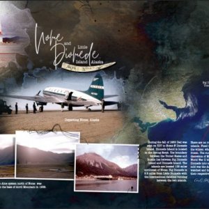
During the fall of 1960 Dad was sent on TDY to Nome & Diomede Island. Diomede Island is located in the Bering Strait. The boundary between the United States and Russia lies between Big Diomede Island and Diomede Island. The islands are located 135 miles northwest of Nome. Big Diomede is 2.5 miles from Little Diomede with the international dateline running between the two islands.
There are no runways on either of the islands. Fixed-wing aircraft land during the winter, when the Bering Strait is frozen. The runway location is at the discretion of Mother Nature. During World War II the Russians turned Big Diomede into a military base. During the cold war, the Americans and Russians watched and listened to each other from their respective islands.
Assets Used:
Tribute Template Album No. 1 https://www.oscraps.com/shop/Tribute-Template-Album-No.-1.html
Scenic Layered Template Album No. 1 https://www.oscraps.com/shop/Scenic-Layered-Template-Album-No.-1.html
UrbanThreadz Framed No. 1 https://www.oscraps.com/shop/UrbanThreadz-Framed-No.-1.html
UrbanThreadz No. 1 https://www.oscraps.com/shop/UrbanThreadz-No.-1.html
ArtsyStains No. 2 https://www.oscraps.com/shop/ArtsyStains-No.-2.html
Additional Assets
Daily Texture
- Designer(s) Used:


